The city is located near Ecuador's Pacific Coast. A major seaport, it is located on the bank of the Rio Guayas river. This river is a tidal river. Although its flow is generally seaward, the direction varies with the semidiurnal tidal cycle. The river flows inward during the flood tide. The river waters are also brackish.
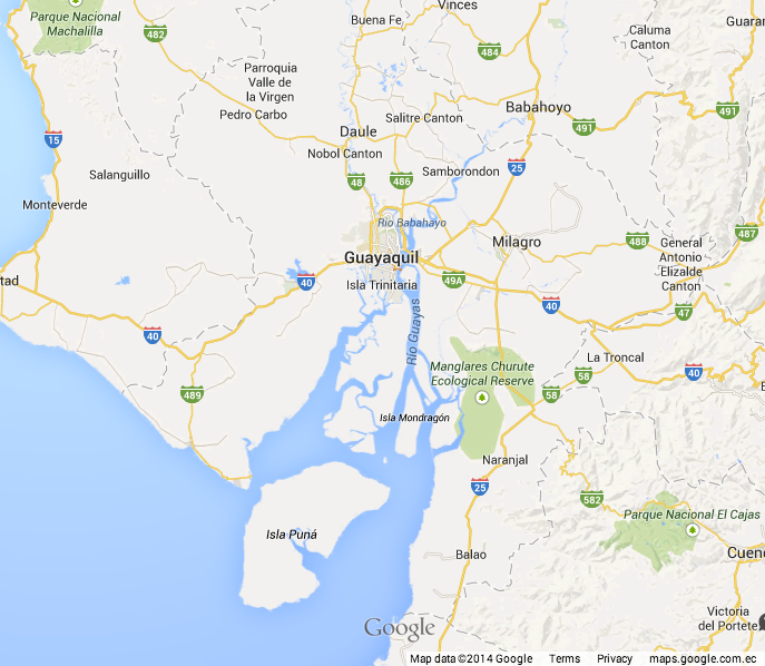 |
| Guayaquil is located on the bank of the Rio Guaya, flowing from Ecuador's coastal lowlands into the Pacific river. |
Guayaquileños — those who live here — talk about their "Everglades." Mangrove swamps sit along the banks of the Rio Guaya. The city — as with its U.S. Florida "namesake" — fights to conserve the mangroves. They have been destroyed for development and for shrimp farming.
 |
| Guayaquil's mangrove swamps support a variety of aquatic life. |
Conservation efforts are also important to Guayaquil's economic health. The city serves as one of the largest sea ports along northern South America's Pacific Coast. Silt accumulation threatens the navigability of the channels into the port. Deep-draft vessels are currently restricted to entry and exit during hight tide.
Guayaquil is in the Southern hemisphere at about two degrees south Latitude. The weather does not change all that much during the year. Locals talk about a rainy season and a dry season. We are currently in the dry season. Our daily temperatures have been in the low to mid 80s.
 |
| We experience daily high temperatures in the low- to mid-80s Fahrenheit. |
Guayaquil also does not experience significant changes to its length of day. The longest day of the year — at the December solstice — has only about 30 minutes more daylight than at the equinox. That is, there are about 12½ days of daylight. Washington, DC, USA, my home, experiences about 15 hours of total daylight at its solstice.
Guayaquil is one of the oldest cities in the Americas. It was founded in 1538. The region sought to remain an independent state during Northern South America's struggle for Independence from Spain. It ultimately became part of the unified Gran Colombia.
 |
| La Iglesia de la Cerra Santa Ana is located on Las Peñas, Guayaquil's historical center. |
Gran Colombia ultimately devolved into three distinct nations — Colombia, Ecuador, and Venezuela. The three countries' national flags contain the same three tricolors. The flag of Guayaquil contains colors resembling those of Argentina. This may be due to Jose San Martin's involvement in mediating Guayaquil's unity with Ecuador.
 |
| A still-operating lighthouse sits atop Cerra Santa Ana. |
 |
| The proximity of modern luxury residences to more-modest abodes exemplifies economic inequality in Guayaquil. |
Guayaquil maintains clean, attractive public spaces. The Malecón is the best example. This three-kilometer walkway serves as a popular gathering place on weekends and holidays. I arrived on the weekend commemorating National independence. The Malecón was packed.
 |
| On the Malecón, Guayaguil's public waterfront park. |
No comments:
Post a Comment